Saturday 21 May 2016

Ride with Andy Saturday (GS Challenge)

Next Saturday (28th May), Bluemooner (Andy) will be passing through Shropshire riding his new GSA on our way to meet up with other members of GSCLUBUK the  GS Challenge.


Riding the Best of Shropshire and Mid-Wales (Powys).

Meet at Ironbridge, then across to Much Wenlock, over Long Mynd down to Clun, then to the Bikers Cafe, Crossgates, Rhayader, Elan Valley (optional), then past the Red Kite centre before dropping down into the Brecons.

130 Miles. This should get him there for just after 3PM, if not sooner !

Get the GPX here: Ironbridge to Ancient Briton

Meet Address:
Darbys of IronbridgeCafe
10 Tontine Hill, Ironbridge, Telford TF8 7AL
View Map


Sunday 15 May 2016

The Wye Valley; in the shadow of the Black Mountains

Today's ride saw myself and Lindsay on a figure eight route through Herefordshire and a brief hop across the border into Powys. We made an early morning start leaving my house at 7:15, a cool eight degrees in bright sunshine meant my choice of summer gloves was way too optimistic, the temperature remained too cool throughout, prompting me to 'flick' the heated grip switch somewhere south of Bromyard.


It was so good to have the roads to ourselves, a lesson taken from the ride in the Cotswolds last weekend meant there was simply nothing else on the road allowing us to 'bat' along at a decent speed through some of the counties best 'B' road twists and turns passing apple orchards and cider farm shops along the way.

The pre-planned route (another late night session hunting for new/different roads of interest) took us just south of Hereford past Stirling Lines at Credenhill (the SAS base I pointed out to Lindsay) and along the edge of those formidable looking 'Black Mountains' just north of the Brecons near Whitney on Wye.  I really enjoy riding that fast A438 as it hugs up near the River Wye and passes by Baskerville Hall up high on the right where Arthur Conan Doyle used to stay as a guest and inspired his Sherlock Holmes story The Hounds of the Baskerville.

Baskerville Hall
We dropped down on to the B4350 having a lot of fun in the sun now as I could simply roll on and off the throttle in an out of bends taking care to avoid the occasional collection of gravel on each apex. Not sure where all of that gravel comes from, it occasionally catches me off guard causing a quick adjust without using the brakes and extra care with the throttle as I come out of the tighter bends. We stopped by a Cafe in Hay on Wye, after a short wait for them to open and a warm in the sun we ordered a couple of ham and cheese Omelettes. 

Moccas Park

From Hay on Wye we cut back east through Bredwardine and passed by Moccas Park - I must stop and take a look next time, the medieval deer park and lake looked like a typical English country estate with what looked like large Oak trees - hundreds of years old. To quote the Government publication of Hereford's Natural Nature Reserves

"The land shows evidence of habitation dating back to at least the Bronze Age, with a wealth of well preserved features, including at least 1 Bronze Age round barrow, a Norman motte and bailey and an 18th century park wall and lime kiln."

"The ancient trees host a large variety of epiphytic plants (plants that grow non-parasitically on other plants). More than 200 species of lichen have been recorded and a wide range of fungi grow in the forest and grassland, some of them very rare."

The ride north then took us over Bishops Frome and the Bromyard Downs before taking us up to Tenbury Wells via the sublime B4203. I love that road, a typical 'B' road but well surfaced with fantastic views of the Herefordshire countryside, remembering to also look at the view in the mirrors as we climbed up hills and dropped back down the other side.  From Tenbury we took the usual route home via Bewdley - made it back for just after midday. 130 miles round trip for me and a bit more for Lindsay!

Sunday 8 May 2016

Rendezvous with the Captain ... 09:30 hrs

Last week I took orders to attend a brief with my captain down in the Cotswold village of Burford. It had been five long years since I last met with him, so I was much pleased to ride down on on such a fine Spring Sunday morning remembering that last campaign I served under him; the defeat of Ralph the Red Barron at that infamous 'bridge'. History recounts the campaign well, with such clarity and accuracy thanks to the excellent report in dispatches. You can read the full account here.

The weather forecast predicted a warm day at last, with slight rain early in the morning. I was due to meet Steve at 09:30 so left home around 07:30, the route planned as described in the previous post would take me across country through B roads into Oxfordshire and the Cotswolds taking in small villages like Toddington, Ford, Temple Guiting and Guiting Powers, then on through Naunton, Bourton on the Water and Great Rissington . Very few bikes on the road at this time either, though I did pass Mick - one of Lindsay's mates coming in the opposite direction just south of Pershore, unmistakable on his white R80/GS, we exchanged a wave but I doubt he recognised me.

It was so good to ride through the Cotswolds with zero traffic for a change. The early start, cool after slight rain as the day warmed up I couldn't get over the fragrance of Spring in the air with the unmistakable intense blossom and rapeseed fields in bright yellow bloom.

For this ride down I had plotted the journey using MotoGoLoco - on-line motorcycle route planning software that uses Google Maps. As I understand Ride magazine now use this site to host their download routes. The software is a lot easier to use than the Garmin Basecamp software, so I was interested in how it would perform. The basic idea is to plot a route using Way points to force the Garmin GPS to take your chosen route. You can view the route I made in MotoGoLoco here.


Zumo showing the Waypoint at Naunton.
I'm pleased to say the route I plotted worked flawlessly. My concern at first would be how the Garmin would interpret the way-points, as each route to a way-point showed on the unit as a separate route with an individual 'Go' button. I wondered if following the route I would be expected to pull over and select the next part of the route. Fortunately, the Garmin continued the route seamlessly, moving from one way-point route to the next without issue.


I couldn't resist pulling over to take a few pictures of the Cotswold countryside, lit up with the carpet of rapeseed yellow fields. That distinctive aroma that reminds me of bike trips away in Northern France on Harley tours with Rob, where we first met up with Steve all those years ago in some French town I can't remember now.

Sea of rapeseed


I arrived at Burford just as Steve was arriving too. It was great to see him after so long. I couldn't believe it was almost five years since we last met at the MotoGP, Silverstone where Steve got me in the BDRC area for a great day out watching the racing. Today we discussed plans for an upcoming tour we have planned, I'm really looking forward to it.

Steve and his very smart K1200GT
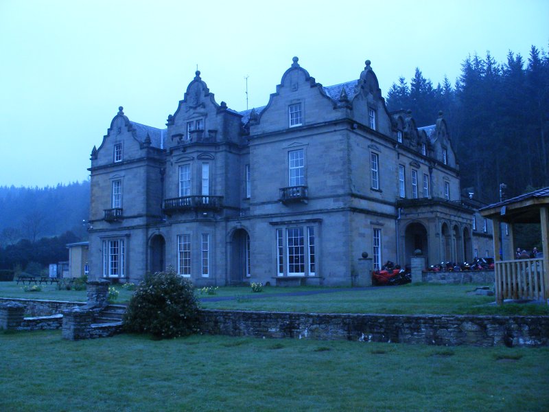
Parked up outside some pile in Guiting Powers. 
 For the route home I chose the 'TracBac' function on the Garmin. The function reversed the route I came down, but then I adjusted it slightly heading back through Pershore and then Upton on Severn before skirting around Worcester and down to Martley where I met with a chap on very nice matt grey Ducati Multistrada - we had a bit of fun on the twisty run up to Martley, but I'm afraid he left me for dust as we approached Great Witley. A quick blast along the switchbacks in Bewdley .. arriving home about 2:30pm.


This house will do !
Super ride and great scenery but you must get up early before the tourists clog the roads up though. Also, avoid the main roads and pick as many B roads as you can to experience the best of the Cotswolds. I'm really impressed with MotoGoLoco so far. It's the easiest/fastest software I have used for route planning. I will definitely be using it again! 


Friday 6 May 2016

Motogoloco


Have been experimenting with some great on line GPS mapping software today called MotGoLoco

I really like it so far, an absolute breeze to use compared to Basecamp or even Tyre for that matter. The software works while you are on line via Google Maps, and allows you to build up your own on-line database of routes. You can export the route to a .GPX (Garmin/TomTom file), ITN (TomTom), KML (Google Map),  CSV and other formats locally to your system. The Software runs in your browser (I used Chrome), and can even connect direct to your GPS device to save the file, or write it out to a file (export). It requires registration, but is really fast at plotting and easy to use.

For a simple test, I saved a route I will be riding this weekend to a GPX file ready for my Garmin 390, but also exported to a KML file, and dragged it in to the 'My Maps' within Google Maps, set it to public share and embedded it here in my blog. Hopefully, if it all went well you should see the route below:


Here's the same route via the MotoGoLoco website: Ride to Burford in the Cotswolds

I'll do a write up how the actual MotoGoLoco route ride went  later. Watch this space as they say.